Hans was keen on a second hike in Bryce Canyon National Park before we headed to our next destination.
Since the drive from Bryce Canyon National Park to Hurricane just outside Zion National park is only a few hours, Hans had time to hike the short good Queens/Navajo combination loop of 4.6km. Di was feeling lazy so dropped him off with a promise to collect him by 10am. An hour before checkout time of 11am.


In winter this road does not exist! We found out later than the last big dump of snow here was just 2 weeks ago. 


As it was 7.30am what did Di see whilst driving into and out of the National Park? Stupid deers of course! A group of about 10 standing right beside the road. Di slowed drastically and honked just to make sure they moved back into the forest. ##!*! Deer.
Di did some blogging and packed and went back for Hans just under 2 hours from when she dropped him off.
In the meantime Hans walked the Queens Garden and Navajo Loops from Sunset Point. The guides said 2-3 hours. Conservative. Hans hiked the loop in 90 minutes but found it a bit of an anticlimax compared to his great hike Fairylands Loop Trail yesterday.
It was a cool crisp, lovely spring morning but not as cold and crisp as yesterday.
Still some great sights. Apparently this is Queen Victoria.
An early morning Hans selfie down in Bryce Canyon.
The morning sun looked great on the rock formations. Again.
A switchback trail to climb back out of the canyon (but less than 200m). Again for Hans this was a piece of cake compared to yesterday. It was actually steeper here than on the Fairylands Loop Trail from yesterday but it wasn't for long. What you see here is pretty much the full extent of the ascent.
Hans had time for a break and snack before Di returned and took him back to the hotel for a well deserved (and needed) shower.
Leaving Bryce Canyon National Park (the best so far), we opted for a scenic route to Hurricane. A recommended Scenic Byway was via Panguitch Lake on UT 143 road to Cedar Breaks National Monument and then back through Duck Creek on UT 148 south. It did not quite work out as planned but boy was it scenic. Just fantastic.
So we were not driving on UT 89 and laughed when we came across this sign. We were on the 143 leaving Panguitch (see sign to the right).
Panguitch looked great this mild spring morning with snowclad mountains in the background.
Here, at Panguitch Lake we had an eagle circling above us presumably looking for a feed from the lake.
What the road map did not show is how high UT 143 climbs to Cedar Breaks National Monument. We came across more and more snow, which for us is a novelty. So we had to stop and play. Yes, the air temperature was still warm enough to be out there in a t-shirt.
Then as the road climbed further the snow got "more serious" but still looked fabulous.
At the top of the mountain we turned left onto UT148 south and... This is what we saw...
Ok. Change of plan. Go north to Brain Head (actually Brian Head but we misread it and it stuck!)
This sign made it very clear why we were driving in a snowfield. The locals in the other car you see here stopped and were laughing when we were taking photos. This is 3,176m elevation and the highest altitude Hans has ever been to. Wow.
Of course the termperature had dropped to about 6-8 degrees as we climbed. A bit cool for our tshirts. We wound our way down to the western side of the mountains, far further north than planned but what a great drive!
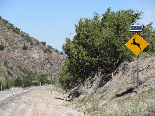
Of course deer paranoia set it again in the forested areas and they even had a special blinking sign for Di. We are coming to get you, Di...
We stopped at The Parowan Cafe in Parowan and had wrangler burgers (on sourdough bread) for lunch. The burgers are delicious but the best thing about the place was the decor and staff. Both were great and welcoming.
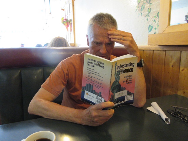
They also provided little books to read while you were waiting. This one still did not clear up the confusion for Hans...
After lunch it only took 1 hour to drive to Hurricane on I-15.
Arriving at Hurricane, we had more than halved our elevation (5,000 feet or less) and the temperature had gone up to about 28 degrees C. Time for a swim in the pool and some sun baking. Remember those pasty bodies from poolside in Las Vegas...
Fascinating and crazy variability in weather conditions today! At least 3 seasons in one day (with no autumn/fall). All within 100 miles. We loved it.
After a shower we walked to the local supermarket. We needed to stretch our legs but found the 15 minute walk a bit sunny and hot!
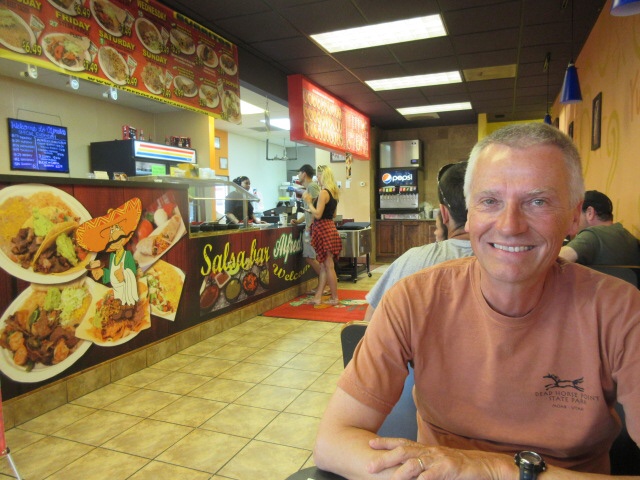
For dinner, we walked two blocks to a cheap Mexican fast food chain called "alfredo's A Mexican food". Yep, that was the name and that was how they spell it. It was rated very highly in Trip Advisor and it didnt disappoint. Very colorful interior too.
Our meals. Plenty of food, very tasty food but perhaps not the most healthy. Nevertheless, we were both happy with our meals as we left the restaurant.
Blue hour over Utah road 9 aka State Street as we walked back to our Super 8 motel.
We passed this on the way. A church in a strip mall. There you go. However, it is Utah after all.
No comments:
Post a Comment